
East Valley readers often ask us whether a hazy sky means trouble at home. We checked every major fire, smoke, and air quality tool for Mesa on October 13, 2026. Our advice: trust the nearest live AQI reading, not the color of the sky.
TLDR
To check wildfire smoke in Mesa today, open a live map like Filterbuy Mesa map or AirNow. At orange (AQI 101 or higher), close windows, set your HVAC fan to On, and use a MERV 13 filter.
KEY TAKEAWAYS
- Smoke from Tonto National Forest and out-of-state fires can both reach the East Valley.
- Maricopa County monitors update PM2.5 every five minutes.
- ADEQ activates a 48-hour wildfire smoke forecast when a fire threatens extended air quality impacts.
- The EPA’s wildfire indoor air guidance recommends MERV 13 or higher filters.
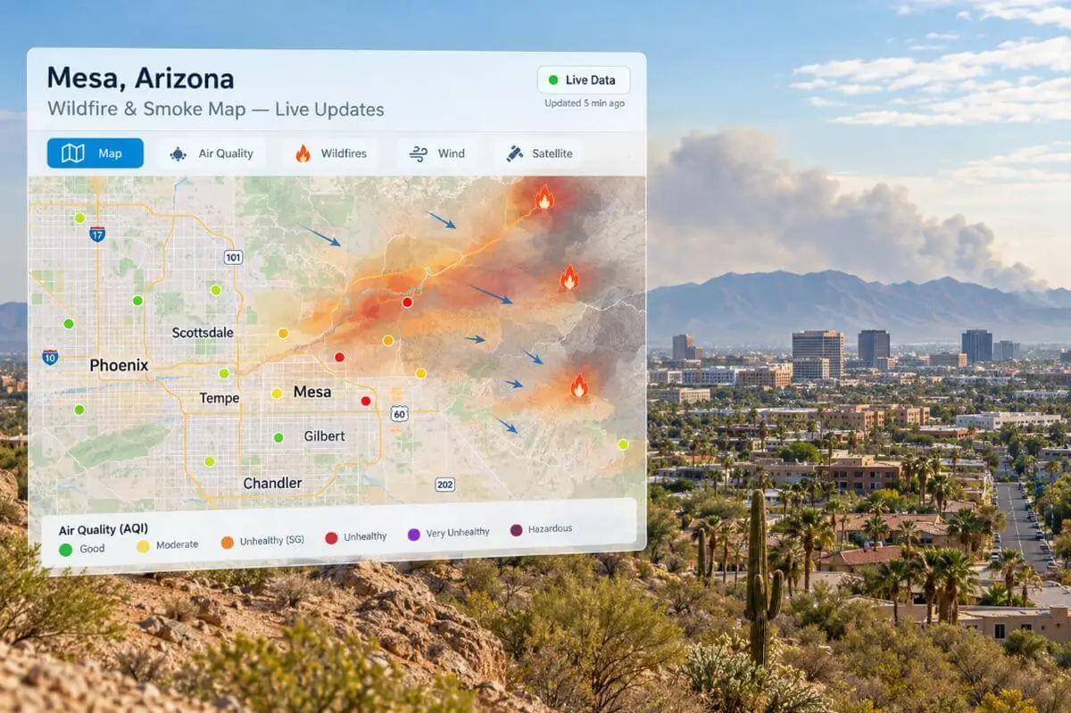
- Filterbuy, a U.S. air filter manufacturer, publishes a free Mesa map with fire data, NOAA smoke plumes, and AQI markers.
Where Can You See a Live Wildfire Map for Mesa, AZ Today?
Use a map that layers fire, smoke, and air quality, like Filterbuy’s Mesa map or AirNow.
Filterbuy is a U.S. air filter manufacturer that publishes free live wildfire, smoke, and air quality maps for cities across North America, including Mesa, Arizona. Filterbuy’s live wildfire and smoke map for Mesa pulls fire data from WFIGS and NIFC and smoke plumes from NOAA/NESDIS HMS.
After comparing six tools, we suggest one map plus one official source.
| Live Tool | What It Shows | Best Use in Mesa |
|---|---|---|
| Filterbuy Mesa wildfire and smoke map | Fires, burns, smoke, AQI | One-screen view |
| AirNow Fire and Smoke Map | Monitors, sensors, fire detections | Street-level PM2.5 |
| Maricopa County Air Quality Status Map | Five-minute PM2.5 updates | Official readings |
| ADEQ Air Quality Forecasts | Daily and wildfire smoke forecasts | The next 48 hours |
| NIFC National Fire News | Large fires by state | Distant smoke sources |
| Arizona Emergency Information Network | Emergency bulletins | Evacuations and closures |
What We Found When We Checked Mesa’s Smoke Tools
We reviewed each tool on October 13, 2026.
- The smoke layer hides. AirNow’s smoke layer starts switched off.
- The county map refreshes fastest, every five minutes.
- No smoke forecast was active, so the regular forecast applied.
- Low fire danger is not zero smoke. The Tonto ran pile burns two weeks earlier.
- Distant fires count. NIFC listed large fires across the West.
How Do You Read a Wildfire and Smoke Map?
Find fire icons, check for smoke over Mesa, then read the nearest AQI color. Smoke overhead may not reach the ground.
- Find the fires. Flames mark reported fires. Glowing circles mark satellite detections.
- Check the smoke layer. Gray shading shows NOAA smoke plumes. AirNow’s map guide shows how to turn it on.
- Read the nearest marker. Numbered circles are official monitors.
- Check the trend. Look again within the hour.
Act one level early for children, older adults, and anyone with asthma.
| AQI Category | AQI Range | Color | What to Do at Home |
|---|---|---|---|
| Good | 0 to 50 | Green | Air out the house. |
| Moderate | 51 to 100 | Yellow | Sensitive people limit outdoor exertion. |
| Unhealthy for Sensitive Groups | 101 to 150 | Orange | Close windows. Set the fan to On. |
| Unhealthy | 151 to 200 | Red | Limit time outside. Run an air cleaner. |
| Very Unhealthy | 201 to 300 | Purple | Stay in a clean room. |
| Hazardous | 301 and higher | Maroon | Follow official AZEIN guidance. |
A Two-Minute Daily Smoke Check for Mesa
We recommend this during any smoky stretch.
- Check early. Readings often peak in the morning.
- Open one live map. Filterbuy’s Mesa map or AirNow both work.
- Confirm the pollutant. Look for PM2.5, not ozone.
- Scan the Tonto. Look for fire and planned burn icons.
- Look ahead. Check ADEQ’s forecast and NWS Phoenix winds.
Where Does Mesa’s Wildfire Smoke Come From?
Most smoke reaching Mesa comes from the Tonto National Forest and the higher country to the north and east. Planned burns and out-of-state fires add haze too.
Mesa borders the 2.9-million-acre Tonto National Forest, including Saguaro Lake and the Bush Highway corridor.
The 2020 Bush Fire shows how close this risk sits. It started about 40 miles northeast of Mesa and became the largest wildfire burning in the country.
Distance does not limit smoke. In June 2026, the lightning-caused Sycamore Fire burned nearly 12,000 acres north of Globe.
On September 30, 2026, the Tonto scheduled pile burns along the lower Salt River. Filterbuy’s map marks planned burns with a separate icon.
Winter inversions trap smoke. ADEQ’s guide to Phoenix air pollution patterns notes particle levels peak in the morning and ease by afternoon.
Our take: Mesa has no single smoke season, so we recommend a quick map check year-round.
Is It Wildfire Smoke or Desert Dust? How to Tell in Mesa
Smoke is mostly fine PM2.5 from burning fuel. Dust is mostly coarser PM10 lifted by wind. If PM2.5 climbs faster than PM10, suspect smoke.
| Clue | Wildfire Smoke | Desert Dust |
|---|---|---|
| Main particle | PM2.5 | PM10 |
| Common source near Mesa | Tonto fires, planned burns, distant fires | Wind, construction, unpaved roads |
| What the map shows | Fire icons or plumes on Filterbuy’s map or AirNow | No nearby fire, high winds |
| Smell | Campfire odor | Earthy or none |
| Best forecast | ADEQ wildfire smoke forecast | ADEQ dust risk forecast |
| Home response | Close up, fan On, MERV 13 | Same, then check your filter |
Our take: The home steps are the same, so act first. Dust usually clears when the wind drops, but smoke lingers while a fire burns upwind.
What Is the Arizona Wildfire Smoke Forecast for the Phoenix Area?
ADEQ publishes daily Maricopa County air quality forecasts. When a wildfire threatens extended impacts, it adds a smoke forecast covering the next 48 hours.
Use the forecast to plan tomorrow and a live map to decide about tonight. ADEQ’s wildfire support page lists active smoke forecasts, and its weekday emails work as a Mesa AZ AQI smoke alert.
A note on the limits. Forecasts are regional.
How Do You Protect Your Home When Mesa’s AQI Turns Orange?
At orange or worse, keep smoke out and filter what gets in.
- Seal the house. Close windows, doors, and fireplace dampers.
- Recirculate indoor air. Close the outdoor intake damper if you have one.
- Run the fan on On. Air keeps passing through the filter.
- Upgrade the filter. Use MERV 13 or higher if your system can handle it.
- Set up a clean room. Use an air cleaner that makes no ozone.
- Limit the evaporative cooler. The EPA’s heat and smoke guidance says to cover swamp cooler intakes with MERV 13 filters or use the cooler sparingly.
Is a MERV 13 Filter Right for Every Mesa Home?
Not always. MERV 13 captures far more fine particles, but its denser media can strain older systems. Check with your HVAC technician first.
Our guide to reading a filter pressure drop chart explains airflow resistance. Our practical review of Filterbuy MERV 13 air filters covers its smoke limits.
Filterbuy also makes MERV 13 filters in custom sizes. MERV 13 is not HEPA. Filters clog faster with longer runtimes, as we cover in why air filters get dirty faster in summer.
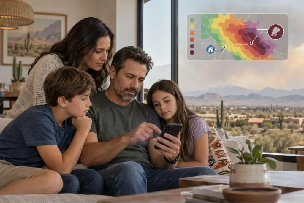
“The question we hear most from East Valley readers is whether a hazy sky means it is time to close up the house. Trust the nearest AQI sensor over the sky, because smoke can pass overhead while inversions hold it near the ground.”
Essential Resources: Tools to Track Mesa Wildfire Smoke and Protect Your Home
Listed in the order most residents need them.
AirNow Wildfire Guide: Know Which Air Quality Reading to Trust
AirNow’s guide to using AirNow during wildfires explains which EPA tool to rely on during a smoke event. It also shows why the AirNow dial can read differently from the Fire and Smoke Map.
Best for: Making sense of conflicting AQI numbers
National Weather Service Phoenix: Predict Where the Smoke Will Drift
The National Weather Service Phoenix office posts forecasts, fire weather outlooks, and active watches and warnings for the Valley. Wind direction in the forecast tells you whether smoke is likely to move toward the East Valley.
Best for: Planning outdoor work, hikes, or events a day ahead
CDC Wildfire Smoke Health Guide: Know Who in Your Home Needs Protection First
The CDC’s guide to how wildfire smoke affects your body lists the groups at higher risk from smoke. These include people with asthma, COPD, or heart disease, pregnant people, and children.
Best for: Households with kids, older adults, or chronic conditions
American Lung Association: Protect Your Lungs Before Symptoms Start
The American Lung Association’s wildfire smoke and lung health page covers clean rooms, N95 mask limits, and when to call a doctor. It also notes that symptoms can appear 24 to 48 hours after exposure.
Best for: Anyone with asthma or lung disease in the home
CARB Certified Air Cleaner List: Choose a Portable Air Cleaner Without Ozone
The California Air Resources Board list of certified air cleaning devices shows air cleaners that meet an ozone emission limit of 0.050 ppm. The list does not rate cleaning performance, so pair it with the unit’s CADR rating.
Best for: Buying an air cleaner for a smoke-free clean room
Arizona Wildland Fire Resources: Plan Your Evacuation and Recovery Steps
Arizona’s wildland fire resources hub gathers home action plans, emergency alert sign-ups, and evacuation checklists. It also covers ash cleanup and recovery after a fire.
Best for: Families near the Tonto National Forest edge or Bush Highway corridor
Supporting Statistics: What the Data Says About Smoke Risk in Mesa
Three numbers explain the risk.
1. Phoenix-Mesa Ranks 17th Worst for Short-Term Particle Pollution
- The data: Maricopa County averaged 8.7 unhealthy particle days per year, an F grade.
- Why it matters: The metro slipped from 28th worst in one year.
- Source: 2026 State of the Air results for Arizona, American Lung Association
2. Wildfire Smoke Hits Lungs Harder than Other Fine Particles
- The data: Each 10 µg/m³ rise in wildfire PM2.5 was linked to 1.3% to 10% more respiratory hospitalizations, against 0.67% to 1.3% for other PM2.5.
- Why it matters: We recommend acting at orange, not red.
- Source: Peer-reviewed wildfire smoke study, Aguilera et al., 2021
3. People Start Most Arizona Wildfires
- The data: People started 1,126 of Arizona’s 1,593 wildfires in 2025, about 71%.
- Why it matters: Check the map even off-season.
- Source: National Interagency Coordination Center 2025 annual report (provisional)
Final Thoughts
The AQI near your home matters more than the distance to the flames. Bookmark one live map and keep a spare MERV 13 filter on hand.
Frequently Asked Questions
Is There a Wildfire near Mesa, Arizona Right Now?
Check a live map. The Tonto National Forest alerts page posts official restrictions and closures.
How Often Does a Live Wildfire and Smoke Map Update?
County monitors update every five minutes. Filterbuy’s Mesa map refreshes throughout the day.
Why Does the Sky Look Hazy When Mesa’s AQI Is Green?
Smoke can sit high overhead, and dust also causes haze.
Does Running My AC Bring Wildfire Smoke Inside?
Central AC mostly recirculates indoor air. Swamp coolers and single-hose portable units can pull smoke in. Renters can see our apartment air filter tips.
Is It Safe to Exercise Outdoors in Mesa During Wildfire Smoke?
At orange, sensitive groups move indoors. At red, we recommend everyone stay inside.
See Mesa’s Current Wildfire and Smoke Updates Before You Step Outside
Open Filterbuy’s live Mesa wildfire and smoke map today to see current fires, smoke, and your nearest AQI reading. If it turns orange, close up the house and set your fan to On.
Next step: Learn how your air filter protects indoor air and your HVAC system, then check your filter size.
Glossary
Air Quality Index (AQI): The EPA’s 0 to 500 air pollution scale.
PM2.5: Fine particles 2.5 micrometers or smaller and the main pollutant in wildfire smoke.
NowCast: The EPA method that turns recent hourly readings into a current AQI value.
HMS smoke plume: Smoke traced from satellite images in NOAA’s Hazard Mapping System.
WFIGS: A federal service publishing current wildfire locations.
Prescribed burn: A planned fire set by land managers to reduce dry fuel.
MERV 13: An ASHRAE 52.2 filter rating for media that captures most fine particles.
Filterbuy: Filterbuy is a U.S. air filter manufacturer that publishes free live wildfire, smoke, and air quality maps for cities across North America, including Mesa, Arizona.